
Refuge Luigi Cibrario topographic map
Interactive map
Click on the map to display elevation.
About this map
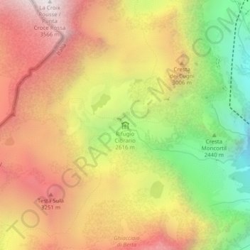
Name: Refuge Luigi Cibrario topographic map, elevation, terrain.
Average elevation: 2,825 m
Minimum elevation: 1,988 m
Maximum elevation: 3,538 m
Other topographic maps
Click on a map to view its topography, its elevation and its terrain.
Rifugio Cibrario
Rifugio Cibrario, Decauville Monte Basso - Lago Dietro la Torre, Ussel, Unione Montana Alpi Graie, Turin, Piémont, 10070, Italie
Average elevation: 2,819 m
Rochemelon
Rochemelon, Ussel, Unione Montana Alpi Graie, Turin, Piémont, Italie
Average elevation: 2,895 m