
Struben Dam topographic map
Interactive map
Click on the map to display elevation.
About this map
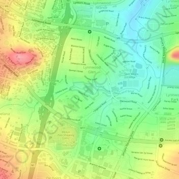
Name: Struben Dam topographic map, elevation, terrain.
Average elevation: 1,385 m
Minimum elevation: 1,337 m
Maximum elevation: 1,442 m
Other topographic maps
Click on a map to view its topography, its elevation and its terrain.
Trim Park
South Africa > Gauteng > City of Tshwane Metropolitan Municipality > Pretoria
Trim Park, Wonderboom South, Tshwane Ward 54, Pretoria, City of Tshwane Metropolitan Municipality, Gauteng, South Africa
Average elevation: 1,270 m
Kruin Park
South Africa > Gauteng > City of Tshwane Metropolitan Municipality > Pretoria
Kruin Park, Lukasrand, Tshwane Ward 59, Pretoria, City of Tshwane Metropolitan Municipality, Gauteng, South Africa
Average elevation: 1,380 m
Apies
South Africa > Gauteng > City of Tshwane Metropolitan Municipality > Pretoria
Apies, Pretoria, City of Tshwane Metropolitan Municipality, Gauteng, South Africa
Average elevation: 1,250 m
Faerie Glen Nature Reserve
South Africa > Gauteng > City of Tshwane Metropolitan Municipality > Pretoria
Faerie Glen Nature Reserve, Tshwane Ward 46, Pretoria, City of Tshwane Metropolitan Municipality, Gauteng, South Africa
Average elevation: 1,385 m
Freedom Park
South Africa > Gauteng > City of Tshwane Metropolitan Municipality > Pretoria
Freedom Park, Tshwane Ward 59, Pretoria, City of Tshwane Metropolitan Municipality, Gauteng, South Africa
Average elevation: 1,390 m
Prince's Park
South Africa > Gauteng > City of Tshwane Metropolitan Municipality > Pretoria
Prince's Park, Salvokop, Tshwane Ward 60, Pretoria, City of Tshwane Metropolitan Municipality, Gauteng, South Africa
Average elevation: 1,325 m