
Paarlo topographic map
Interactive map
Click on the map to display elevation.
About this map
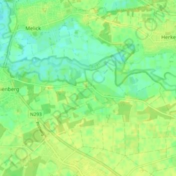
Name: Paarlo topographic map, elevation, terrain.
Average elevation: 30 m
Minimum elevation: 21 m
Maximum elevation: 35 m
Other topographic maps
Click on a map to view its topography, its elevation and its terrain.
Lerop
Nederland > Limburg > Sint Odiliënberg
Lerop, Sint Odiliënberg, Roerdalen, Limburg, Nederland, 6077 NX, Nederland
Average elevation: 26 m