
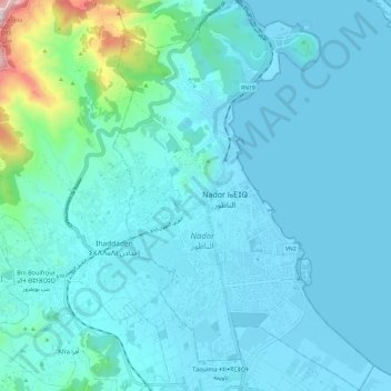
Pachalik de Nador باشوية الناظور topographic map
Interactive map
Click on the map to display elevation.
About this map
Name: Pachalik de Nador باشوية الناظور topographic map, elevation, terrain.
Average elevation: 91 m
Minimum elevation: -2 m
Maximum elevation: 865 m
Other topographic maps
Click on a map to view its topography, its elevation and its terrain.
Marrakesh
Morocco > Pachalik de Marrakech > Marrakesh
By road, Marrakesh is located 580 kilometres (360 mi) southwest of Tangier, 327 kilometres (203 mi) southwest of the Moroccan capital of Rabat, 239 kilometres (149 mi) southwest of Casablanca, 196 kilometres (122 mi) southwest of Beni Mellal, 177 kilometres (110 mi) east of Essaouira, and 246 kilometres (153…
Average elevation: 485 m
Beni Habbane
Morocco > Cercle d'Oujda-Banlieue nord دائرة وجدة-الضاحية الشمالية > Ain Sfa
Average elevation: 859 m
Amougar-n-Ait Marghad
Morocco > Cercle de Goulmima دائرة كلميمة > Amellagou املاكو
Average elevation: 1,605 m
Souani
Morocco > Cercle de Bni Ouriaghel Acharkia دائرة بني ورياغل > Ait Youssef Ou Ali
Average elevation: 9 m
RP2030
Morocco > Cercle de Tahannaout دائرة تحناوت > Oukaimeden > Ait el Qaq
Average elevation: 2,502 m
Ifegh
Morocco > Cercle de Goulmima دائرة كلميمة > Aghbalou N'Kerdous اغبالو انكردوس
Average elevation: 1,321 m
Toubkal
Morocco > cercle d'Asni > Asni
Toubkal, also Jbel Toubkal or Jebel Toubkal, is a mountain in southwestern Morocco, located in the Toubkal National Park. At 4,167 m (13,671 ft), it is the highest peak in Morocco, the Atlas Mountains, North Africa and the Arab world. Located 63 km (39 mi) south of the city of Marrakesh, and visible from it,…
Average elevation: 3,616 m
Atlas Mountains
Morocco > cercle de Taliouine > Toubkal ⵜⵓⴱⵇⴰⵍ توبقال
The Atlas Mountains are a mountain range in the Maghreb in North Africa. It separates the Sahara Desert from the Mediterranean Sea and the Atlantic Ocean; the name "Atlantic" is derived from the mountain range, which stretches around 2,500 km (1,600 mi) through Morocco, Algeria and Tunisia. The range's highest…
Average elevation: 3,402 m
Doukkala Sahel
Morocco > cercle de Oued El Makhazine دائرة وادي المخازن > Khemis Sahel
Average elevation: 13 m
Berhout برغوت
Morocco > cercle de Driouch دائرة الدريوش > Dar El Kebdani > Tijdit تيجدشت
Average elevation: 326 m