
岳东镇 topographic map
Interactive map
Click on the map to display elevation.
About this map
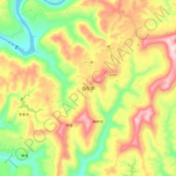
Name: 岳东镇 topographic map, elevation, terrain.
Location: 岳东镇, 苍溪县, 广元市, 四川省, 中国 (31.91553 106.18909 31.99553 106.26909)
Average elevation: 656 m
Minimum elevation: 408 m
Maximum elevation: 925 m
Other topographic maps
Click on a map to view its topography, its elevation and its terrain.