
Donaueschingen topographic map
Interactive map
Click on the map to display elevation.
About this map
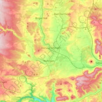
Name: Donaueschingen topographic map, elevation, terrain.
Average elevation: 754 m
Minimum elevation: 562 m
Maximum elevation: 957 m
Other topographic maps
Click on a map to view its topography, its elevation and its terrain.
Gremmelsbach
Germany > Baden-Württemberg > Schwarzwald-Baar-Kreis > Triberg im Schwarzwald > Gremmelsbach
Average elevation: 776 m