Geolocate

Rawang topographic map

Click on the map to display elevation.

About this map

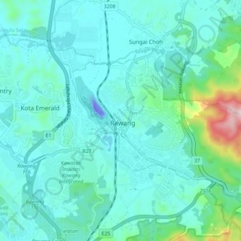
Name: Rawang topographic map, elevation, terrain.

Location: Rawang, Selangor, 48000, Malaysia (3.28041 101.53663 3.36041 101.61663)

Average elevation: 82 m

Minimum elevation: -54 m

Maximum elevation: 554 m

Gear up for your next adventure:

🎒Hiking Daypacks (20L) - Compact backpacks for day trips and technical mountain ascents
🎒Multi-day Trekking Packs - Large capacity backpacks for wild camping and long-distance trails
🧢Hiking Hats - Sun and weather protection for outdoor walks
🛌Insulated Sleeping Mats - Crucial thermal protection when sleeping on cold, uneven ground
🥤Collapsible Water Bottles - Save space in your rucksack as you consume your water

As an Amazon Associate, this site earns from qualifying purchases at no extra cost to you.