Geolocate

Baron topographic map

Interactive map

Click on the map to display elevation.

About this map

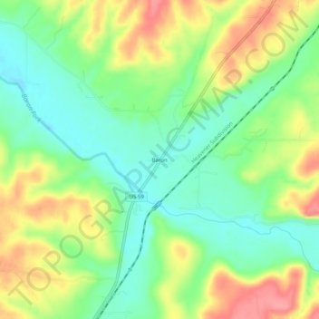
Name: Baron topographic map, elevation, terrain.

Location: Baron, Adair County, Oklahoma, United States (35.90370 -94.63633 35.94370 -94.59633)

Average elevation: 296 m

Minimum elevation: 258 m

Maximum elevation: 348 m

Other topographic maps

Click on a map to view its topography, its elevation and its terrain.

Stilwell

United States > Oklahoma > Adair County

Stilwell, Adair County, Oklahoma, 74960, United States

Average elevation: 352 m

Christie

United States > Oklahoma > Adair County

Christie, Adair County, Oklahoma, United States

Average elevation: 283 m

Proctor

United States > Oklahoma > Adair County

Proctor, Adair County, Oklahoma, United States

Average elevation: 272 m

Cherry Tree

United States > Oklahoma > Adair County

Cherry Tree, Adair County, Oklahoma, United States

Average elevation: 334 m