
Thank you for supporting this site ❤️
Make a donation
Make a donation
Gear up for your next adventure:
As an Amazon Associate, this site earns from qualifying purchases at no extra cost to you.
Huancane topographic map
Click on the map to display elevation.
Thank you for supporting this site ❤️
Make a donation
Make a donation
Gear up for your next adventure:
As an Amazon Associate, this site earns from qualifying purchases at no extra cost to you.
About this map
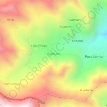
Name: Huancane topographic map, elevation, terrain.
Location: Huancane, Pacobamba, Andahuaylas, Apurímac, Perú (-13.63518 -73.12156 -13.59518 -73.08156)
Average elevation: 3,083 m
Minimum elevation: 2,484 m
Maximum elevation: 3,662 m
Thank you for supporting this site ❤️
Make a donation
Make a donation
Gear up for your next adventure:
As an Amazon Associate, this site earns from qualifying purchases at no extra cost to you.