Geolocate

Meladeia topographic map

Click on the map to display elevation.

About this map
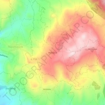
Name: Meladeia topographic map, elevation, terrain.

Location: Meladeia, Paphos District, Cyprus, 8800, Cyprus (34.96795 32.48663 35.00795 32.52663)

Average elevation: 447 m

Minimum elevation: 226 m

Maximum elevation: 655 m

Gear up for your next adventure:

🚶Walking Pedometers - Simple distance tracking for casual trail walkers
🧢Waterproof Hiking Hats - Keep the rain off your face while studying topographic maps
🎒Hiking Daypacks (20L) - Compact backpacks for day trips and technical mountain ascents
👟Waterproof Leg Gaiters - Keep mud and water out of your boots in boggy terrain
🌦️Portable Weather Meters - Handheld tools for monitoring weather conditions

As an Amazon Associate, this site earns from qualifying purchases at no extra cost to you.