
Thank you for supporting this site ❤️
Make a donation
Make a donation
Gear up for your next adventure:
As an Amazon Associate, this site earns from qualifying purchases at no extra cost to you.
Tosari topographic map
Click on the map to display elevation.
Thank you for supporting this site ❤️
Make a donation
Make a donation
Gear up for your next adventure:
As an Amazon Associate, this site earns from qualifying purchases at no extra cost to you.
About this map
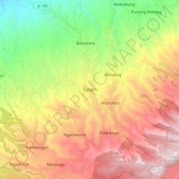
Name: Tosari topographic map, elevation, terrain.
Location: Tosari, Pasuruan, East Java, Java, 67177, Indonesia (-7.92452 112.86108 -7.84452 112.94108)
Average elevation: 1,656 m
Minimum elevation: 760 m
Maximum elevation: 2,524 m
Thank you for supporting this site ❤️
Make a donation
Make a donation
Gear up for your next adventure:
As an Amazon Associate, this site earns from qualifying purchases at no extra cost to you.