
Thank you for supporting this site ❤️
Make a donation
Make a donation
Gear up for your next adventure:
As an Amazon Associate, this site earns from qualifying purchases at no extra cost to you.
Lintao topographic map
Click on the map to display elevation.
Thank you for supporting this site ❤️
Make a donation
Make a donation
Gear up for your next adventure:
As an Amazon Associate, this site earns from qualifying purchases at no extra cost to you.
About this map
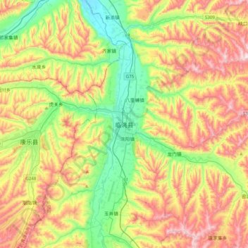
Name: Lintao topographic map, elevation, terrain.
Location: Lintao, Taoyang, Lintao County, Dingxi City, Gansu, China (35.23325 103.69692 35.55325 104.01692)
Average elevation: 2,112 m
Minimum elevation: 1,815 m
Maximum elevation: 2,519 m
Thank you for supporting this site ❤️
Make a donation
Make a donation
Gear up for your next adventure:
As an Amazon Associate, this site earns from qualifying purchases at no extra cost to you.