
Pasir Paniisan topographic map
Interactive map
Click on the map to display elevation.
About this map
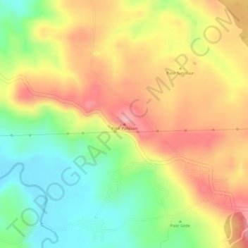
Name: Pasir Paniisan topographic map, elevation, terrain.
Location: Pasir Paniisan, Subang, West Java, Java, Indonesia (-6.55616 107.59384 -6.55606 107.59394)
Average elevation: 151 m
Minimum elevation: 73 m
Maximum elevation: 218 m
Other topographic maps
Click on a map to view its topography, its elevation and its terrain.
PT.Sinkona Lestari Indoesia Backyard Park
Indonesia > West Java > Subang > Subang
Average elevation: 744 m