
Thank you for supporting this site ❤️
Make a donation
Make a donation
Gear up for your next adventure:
As an Amazon Associate, this site earns from qualifying purchases at no extra cost to you.
Jaisamand topographic map
Click on the map to display elevation.
Thank you for supporting this site ❤️
Make a donation
Make a donation
Gear up for your next adventure:
As an Amazon Associate, this site earns from qualifying purchases at no extra cost to you.
About this map
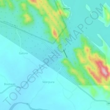
Name: Jaisamand topographic map, elevation, terrain.
Location: Jaisamand, Sarada Tehsil, Salumbar District, Rajasthan, India (24.22086 73.92936 24.26086 73.96936)
Average elevation: 306 m
Minimum elevation: 259 m
Maximum elevation: 530 m
Thank you for supporting this site ❤️
Make a donation
Make a donation
Gear up for your next adventure:
As an Amazon Associate, this site earns from qualifying purchases at no extra cost to you.