
Zhelen topographic map
Interactive map
Click on the map to display elevation.
About this map
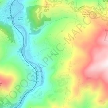
Name: Zhelen topographic map, elevation, terrain.
Location: Zhelen, Svoge, Sofia, 2267, Bulgaria (42.96944 23.35112 43.00944 23.39112)
Average elevation: 722 m
Minimum elevation: 425 m
Maximum elevation: 1,155 m
Other topographic maps
Click on a map to view its topography, its elevation and its terrain.