Geolocate

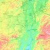
Tongmu topographic map

Click on the map to display elevation.

About this map

Name: Tongmu topographic map, elevation, terrain.

Location: Tongmu, Guiyang, Guizhou, China (26.36310 106.65600 26.40310 106.69600)

Average elevation: 1,114 m

Minimum elevation: 1,056 m

Maximum elevation: 1,254 m

Other topographic maps

Click on a map to view its topography, its elevation and its terrain.
Huaxi

China > Guizhou > Guiyang

Average elevation: 1,227 m

Gear up for your next adventure:

🧭Orienteering Compasses - Accurate compasses for map-based navigation
🌦️Portable Weather Meters - Handheld tools for monitoring weather conditions
🎒Hiking Daypacks (20L) - Compact backpacks for day trips and technical mountain ascents
🐕Dog Hiking Gear - Equipment for hiking safely with dogs
🧊Insulated Flasks - Keeps drinks hot or cold during hikes

As an Amazon Associate, this site earns from qualifying purchases at no extra cost to you.