Geolocate

Edenbridge topographic map

Click on the map to display elevation.

About this map

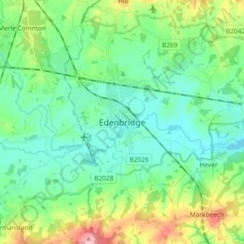
Name: Edenbridge topographic map, elevation, terrain.

Location: Edenbridge, Kent, South East, England, TN8 5DR, United Kingdom (51.15583 0.02393 51.23583 0.10393)

Average elevation: 70 m

Minimum elevation: 33 m

Maximum elevation: 174 m

England trails, hiking, mountain biking, running and outdoor activities

Gear up for your next adventure:

🚲Cycling GPS Computers - Track elevation and topographic routes on two wheels
🎒Hiking Daypacks - Compact backpacks ideal for short hikes and excursions
🎒Multi-day Trekking Packs - Large capacity backpacks for wild camping and long-distance trails
🔥Emergency Fire Starters - Reliable ignition tools for survival situations in damp conditions
🎒Backpack Rain Covers - Universal waterproof covers to protect your gear from downpours

As an Amazon Associate, this site earns from qualifying purchases at no extra cost to you.