
Ibn Yacoub topographic map
Interactive map
Click on the map to display elevation.
About this map
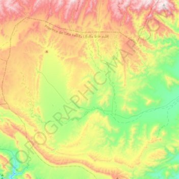
Name: Ibn Yacoub topographic map, elevation, terrain.
Average elevation: 1,351 m
Minimum elevation: 840 m
Maximum elevation: 2,064 m
Other topographic maps
Click on a map to view its topography, its elevation and its terrain.
Tissint
Maroc > cercle de Foum Zguid > Tissint
Tissint, caïdat d' Tissint, cercle de Foum Zguid, Province de Tata, Souss-Massa, 84053, Maroc
Average elevation: 533 m
Akka Ighane
Akka Ighane, caïdat d' Akka-Ighane, cercle de Foum Zguid, Province de Tata, Souss-Massa, Maroc
Average elevation: 955 m
Tlite
Tlite, caïdat d' Allogoum, cercle de Foum Zguid, Province de Tata, Souss-Massa, Maroc
Average elevation: 998 m