
城区 topographic map
Interactive map
Click on the map to display elevation.
About this map
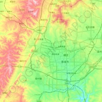
Name: 城区 topographic map, elevation, terrain.
Location: 城区, 晋城市, 山西省, 048000, 中国 (35.42584 112.74965 35.59033 112.91857)
Average elevation: 823 m
Minimum elevation: 592 m
Maximum elevation: 1,157 m
Other topographic maps
Click on a map to view its topography, its elevation and its terrain.