Geolocate

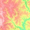
Novoukrainka topographic map

Click on the map to display elevation.

About this map

Name: Novoukrainka topographic map, elevation, terrain.

Location: Novoukrainka, Novoukrainka Urban Hromada, Novoukrainka Raion, Kirovohrad Oblast, 27100-27108, Ukraine (48.28007 31.48003 48.34933 31.56112)

Average elevation: 166 m

Minimum elevation: 77 m

Maximum elevation: 210 m

Other topographic maps

Click on a map to view its topography, its elevation and its terrain.

Yasynuvatka

Ukraine > Kirovohrad Oblast

Average elevation: 120 m

Gear up for your next adventure:

🔦Waterproof LED Headlamps - Hands-free lighting for evening treks and emergency navigation
🎒Replacement Sternum Straps - Repair parts for hiking rucksacks
📸Action Camera Chest Mounts - Record your ascent following topographic paths hands-free
🚶Walking Pedometers - Simple distance tracking for casual trail walkers
🎒Hiking Daypacks - Compact backpacks ideal for short hikes and excursions

As an Amazon Associate, this site earns from qualifying purchases at no extra cost to you.