
Zevenhuizen topographic map
Interactive map
Click on the map to display elevation.
About this map
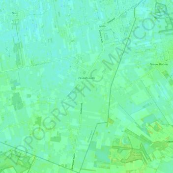
Name: Zevenhuizen topographic map, elevation, terrain.
Location: Zevenhuizen, Westerkwartier, Groningue, Pays-Bas (53.08713 6.28823 53.15668 6.38135)
Average elevation: 5 m
Minimum elevation: 0 m
Maximum elevation: 12 m
Other topographic maps
Click on a map to view its topography, its elevation and its terrain.
Appingedam
Pays-Bas > Groningue > Appingedam
Appingedam, Eemsdelta, Groningue, Pays-Bas
Average elevation: -1 m
Blokstad
Pays-Bas > Groningue > Appingedam > Blokstad
Blokstad, Appingedam, Eemsdelta, Groningue, Pays-Bas, 9902TL, Pays-Bas
Average elevation: -1 m
Sebaldeburen
Pays-Bas > Groningue > Sebaldeburen
Sebaldeburen, Westerkwartier, Groningue, Pays-Bas
Average elevation: 0 m
Westerkwartier
Pays-Bas > Groningue > Westerkwartier
Westerkwartier, Groningue, Pays-Bas
Average elevation: 2 m