
Thank you for supporting this site ❤️
Make a donation
Make a donation
Gear up for your next adventure:
As an Amazon Associate, this site earns from qualifying purchases at no extra cost to you.
Curaray topographic map
Click on the map to display elevation.
Thank you for supporting this site ❤️
Make a donation
Make a donation
Gear up for your next adventure:
As an Amazon Associate, this site earns from qualifying purchases at no extra cost to you.
About this map
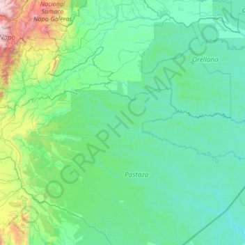
Name: Curaray topographic map, elevation, terrain.
Location: Curaray, Arajuno, Pastaza, 160202, Ecuador (-1.70367 -77.71965 -1.00377 -75.58499)
Average elevation: 481 m
Minimum elevation: 154 m
Maximum elevation: 4,245 m
Thank you for supporting this site ❤️
Make a donation
Make a donation
Gear up for your next adventure:
As an Amazon Associate, this site earns from qualifying purchases at no extra cost to you.