

Prešov topographic map
Click on the map to display elevation.
Prešov
Prešov lies at an altitude of 250 m (820 ft) above sea level and covers an area of 70.4 km2 (27.2 sq mi). It is located in north-eastern Slovakia, at the northern reaches of the Košice Basin, at the confluence of the Torysa river with its tributary Sekčov. Mountain ranges nearby include Slanské vrchy (south-east), Šarišská vrchovina (south-west), Bachureň (west) and Čergov (north). The neighbouring city of Košice is 34 km (21 mi) to the south. Prešov is about 50 km (31 mi) south of the Polish border, 60 km (37 mi) north of the Hungarian border and is some 410 km (250 mi) northeast of Bratislava (by road).
About this map
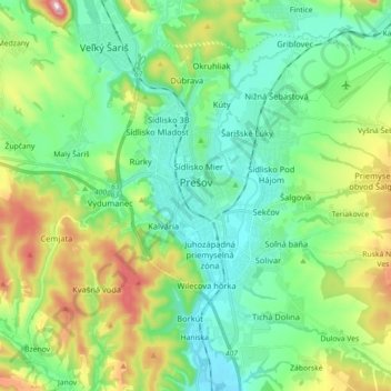
Name: Prešov topographic map, elevation, terrain.
Average elevation: 323 m
Minimum elevation: 226 m
Maximum elevation: 565 m
Other topographic maps
Click on a map to view its topography, its elevation and its terrain.

Nad lomom
Slovakia > Region of Prešov > District of Prešov > Drienovská Nová Ves
Average elevation: 294 m