
Rovte topographic map
Interactive map
Click on the map to display elevation.
About this map
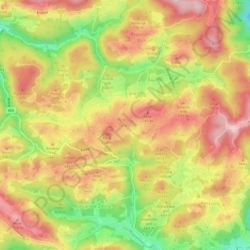
Name: Rovte topographic map, elevation, terrain.
Location: Rovte, Logatec, Upravna Enota Logatec, 1373, Slovénie (45.96541 14.15823 46.00541 14.19823)
Average elevation: 663 m
Minimum elevation: 529 m
Maximum elevation: 762 m