Geolocate

kolur topographic map

Click on the map to display elevation.

About this map

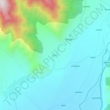
Name: kolur topographic map, elevation, terrain.

Location: kolur, Pahalgam, Anantnag District, Jammu and Kashmir, India (33.89058 75.24163 33.93058 75.28163)

Average elevation: 2,017 m

Minimum elevation: 1,836 m

Maximum elevation: 2,762 m

Gear up for your next adventure:

🗺️Ordnance Survey Maps - Official UK maps for walking and outdoor activities
🐕Dog Hiking Gear - Equipment for hiking safely with dogs
🗺️Topographic Maps - Detailed maps showing elevation and terrain features
👖Convertible Hiking Trousers - Versatile zip-off pants for changing mountain weather conditions
🌦️Portable Weather Meters - Handheld tools for monitoring weather conditions

As an Amazon Associate, this site earns from qualifying purchases at no extra cost to you.