
Biancavilla topographic map
Interactive map
Click on the map to display elevation.
About this map
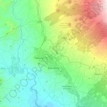
Name: Biancavilla topographic map, elevation, terrain.
Location: Biancavilla, Catania, Sicily, 95033, Italy (37.58627 14.81859 37.75103 14.99537)
Average elevation: 687 m
Minimum elevation: 92 m
Maximum elevation: 2,241 m
Other topographic maps
Click on a map to view its topography, its elevation and its terrain.