
Hittisleigh topographic map
Interactive map
Click on the map to display elevation.
About this map
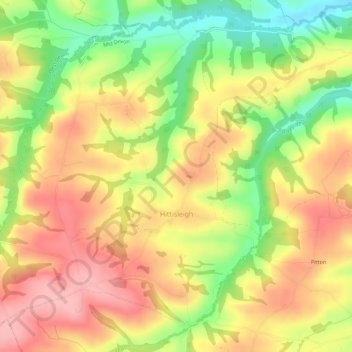
Name: Hittisleigh topographic map, elevation, terrain.
Location: Hittisleigh, Mid Devon, Devon, England, United Kingdom (50.72785 -3.83629 50.76174 -3.78001)
Average elevation: 176 m
Minimum elevation: 100 m
Maximum elevation: 235 m
Devon trails, hiking, mountain biking, running and outdoor activities
Other topographic maps
Click on a map to view its topography, its elevation and its terrain.
Wordland Cross
United Kingdom > England > Devon > Mid Devon > Cheriton Fitzpaine
Average elevation: 120 m