Geolocate

Hutabalang topographic map

Interactive map

Click on the map to display elevation.

About this map

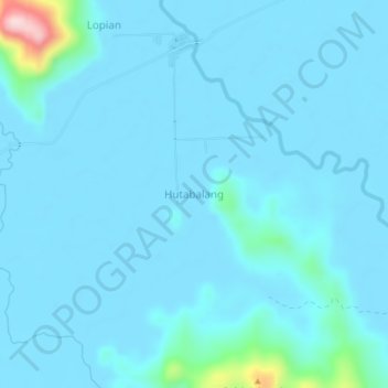
Name: Hutabalang topographic map, elevation, terrain.

Location: Hutabalang, Central Tapanuli, North Sumatra, Sumatra, Indonesia (1.53306 98.82850 1.57306 98.86850)

Average elevation: 20 m

Minimum elevation: 0 m

Maximum elevation: 279 m

Other topographic maps

Click on a map to view its topography, its elevation and its terrain.

Lubuk Ampolu

Indonesia > North Sumatra > Central Tapanuli

Lubuk Ampolu, Central Tapanuli, North Sumatra, Sumatra, Indonesia

Average elevation: 25 m

Pandan

Indonesia > North Sumatra > Central Tapanuli > Pandan

Pandan, Central Tapanuli, North Sumatra, Indonesia

Average elevation: 34 m