
Achupallas topographic map
Interactive map
Click on the map to display elevation.
About this map
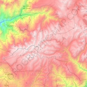
Name: Achupallas topographic map, elevation, terrain.
Location: Achupallas, Alausí, Chimborazo, Ecuador (-2.56733 -78.81235 -2.17280 -78.46211)
Average elevation: 3,460 m
Minimum elevation: 1,468 m
Maximum elevation: 4,494 m
Other topographic maps
Click on a map to view its topography, its elevation and its terrain.
Chimborazo
Ecuador > Chimborazo > San Andrés
Chimborazo, San Andrés, Guano, Chimborazo, Ecuador
Average elevation: 5,697 m