
Wangle topographic map
Interactive map
Click on the map to display elevation.
About this map
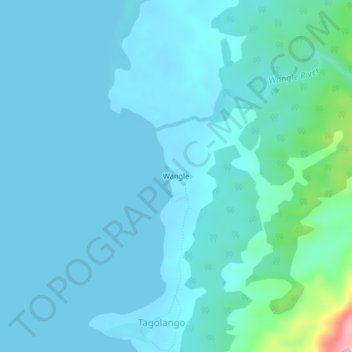
Name: Wangle topographic map, elevation, terrain.
Location: Wangle, Palawan, Mimaropa, Filipijnen (8.46003 117.19939 8.50003 117.23939)
Average elevation: 23 m
Minimum elevation: -2 m
Maximum elevation: 221 m
Other topographic maps
Click on a map to view its topography, its elevation and its terrain.
Calauit
Filipijnen > Palawan > Calauit
Calauit, Busuanga, Palawan, Mimaropa, 5317, Filipijnen
Average elevation: 10 m