
Thank you for supporting this site ❤️
Make a donation
Make a donation
Gear up for your next adventure:
As an Amazon Associate, this site earns from qualifying purchases at no extra cost to you.
Mveng topographic map
Click on the map to display elevation.
Thank you for supporting this site ❤️
Make a donation
Make a donation
Gear up for your next adventure:
As an Amazon Associate, this site earns from qualifying purchases at no extra cost to you.
About this map
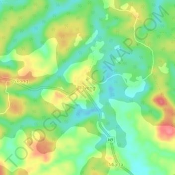
Name: Mveng topographic map, elevation, terrain.
Location: Mveng, Djoum, Dja-et-Lobo, Région du Sud, Cameroun (2.72957 12.60130 2.76957 12.64130)
Average elevation: 659 m
Minimum elevation: 627 m
Maximum elevation: 704 m
Thank you for supporting this site ❤️
Make a donation
Make a donation
Gear up for your next adventure:
As an Amazon Associate, this site earns from qualifying purchases at no extra cost to you.