
Monmouth topographic map
Click on the map to display elevation.
About this map
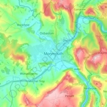
Name: Monmouth topographic map, elevation, terrain.
Location: Monmouth, Monmouthshire, Wales, NP25 3UZ, United Kingdom (51.76989 -2.75604 51.84989 -2.67604)
Average elevation: 101 m
Minimum elevation: 8 m
Maximum elevation: 274 m
Monmouthshire trails, hiking, mountain biking, running and outdoor activities
Other topographic maps
Click on a map to view its topography, its elevation and its terrain.