
Morcles topographic map
Interactive map
Click on the map to display elevation.
About this map
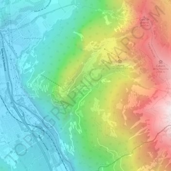
Name: Morcles topographic map, elevation, terrain.
Location: Morcles, Lavey-Morcles, District d'Aigle, Vaud, 1892, Suisse (46.18890 7.01637 46.22890 7.05637)
Average elevation: 1,139 m
Minimum elevation: 406 m
Maximum elevation: 2,460 m
Other topographic maps
Click on a map to view its topography, its elevation and its terrain.
Cabane de la Tourche
Suisse > Vaud > District d'Aigle > Lavey-Morcles > Morcles
Cabane de la Tourche, approximate, Morcles, Lavey-Morcles, District d'Aigle, Vaud, 1892, Suisse
Average elevation: 2,015 m