
San Andrés Villa Seca topographic map
Interactive map
Click on the map to display elevation.
About this map
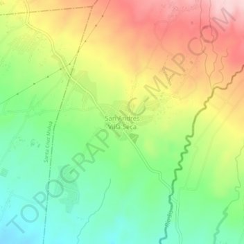
Name: San Andrés Villa Seca topographic map, elevation, terrain.
Location: San Andrés Villa Seca, Retalhuleu, Guatemala (14.55780 -91.60526 14.59780 -91.56526)
Average elevation: 462 m
Minimum elevation: 359 m
Maximum elevation: 592 m