
Danghyeon-ri topographic map
Interactive map
Click on the map to display elevation.
About this map
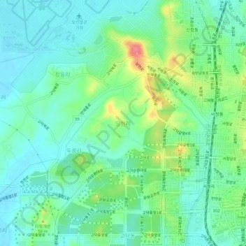
Name: Danghyeon-ri topographic map, elevation, terrain.
Location: Danghyeon-ri, Pyeongtaek-si, 18007, South Korea (37.04634 127.01546 37.08634 127.05546)
Average elevation: 27 m
Minimum elevation: 7 m
Maximum elevation: 77 m
Other topographic maps
Click on a map to view its topography, its elevation and its terrain.