Geolocate

Mazo topographic map

Click on the map to display elevation.

About this map

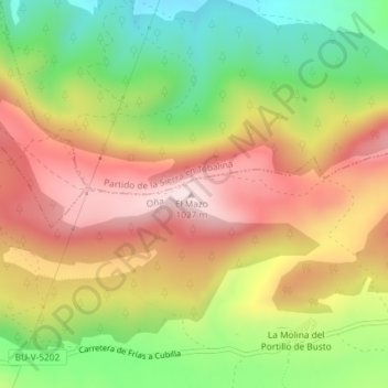
Name: Mazo topographic map, elevation, terrain.

Location: Mazo, Oña, Burgos, Castile and León, Spain (42.71414 -3.24212 42.71424 -3.24202)

Average elevation: 839 m

Minimum elevation: 650 m

Maximum elevation: 1,017 m

Gear up for your next adventure:

🧴Sport Sunscreen Sticks - High-protection sunblock that won't run into your eyes on the trail
🛰️Handheld GPS Devices - Reliable GPS units for hiking and outdoor navigation
🧤Hiking Gloves - Warm and durable gloves for cold-weather walks
🔋Lithium AA Batteries - Long-lasting power that performs well in cold mountain weather
🔋Solar Power Banks - Keep your GPS and phone charged during multi-day expeditions

As an Amazon Associate, this site earns from qualifying purchases at no extra cost to you.