
Whitehall topographic map
Interactive map
Click on the map to display elevation.
About this map
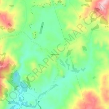
Name: Whitehall topographic map, elevation, terrain.
Location: Whitehall, Waipa District, Waikato, New Zealand (-37.89723 175.56308 -37.85723 175.60308)
Average elevation: 157 m
Minimum elevation: 53 m
Maximum elevation: 324 m
Other topographic maps
Click on a map to view its topography, its elevation and its terrain.