Geolocate

Bonham topographic map

Click on the map to display elevation.

About this map

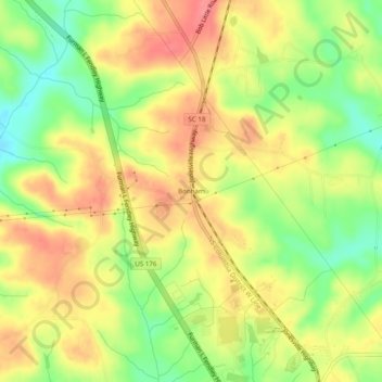
Name: Bonham topographic map, elevation, terrain.

Location: Bonham, Union County, South Carolina, United States (34.75680 -81.66649 34.79680 -81.62649)

Average elevation: 192 m

Minimum elevation: 150 m

Maximum elevation: 226 m

Other topographic maps

Click on a map to view its topography, its elevation and its terrain.

Carlisle

United States > South Carolina > Union County

Average elevation: 135 m

Jonesville

United States > South Carolina > Union County

Average elevation: 194 m

Gear up for your next adventure:

🔪Outdoor Multi-Tools - Versatile tools for gear repairs and food prep in the wild
🛑Emergency Bivvy Bags - Heat-reflective survival bags for unexpected nights out
GPS Outdoor Watches - Watches with GPS tracking for hiking and exploration
🧭Orienteering Compasses - Accurate compasses for map-based navigation
📚UK Hiking Guidebooks - Detailed route descriptions for the Lake District, Peaks, and Highlands

As an Amazon Associate, this site earns from qualifying purchases at no extra cost to you.