Geolocate

Infiernillo topographic map

Click on the map to display elevation.

About this map

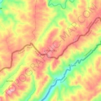
Name: Infiernillo topographic map, elevation, terrain.

Location: Infiernillo, Paletillas, Zapotillo, Loja, Ecuador (-4.23131 -80.35196 -4.19131 -80.31196)

Average elevation: 512 m

Minimum elevation: 395 m

Maximum elevation: 590 m

Gear up for your next adventure:

👖Convertible Hiking Trousers - Versatile zip-off pants for changing mountain weather conditions
📸Action Camera Chest Mounts - Record your ascent following topographic paths hands-free
📱Phone Mounts for Hiking - Secure mounts to carry your phone on trails
🧴Sport Sunscreen Sticks - High-protection sunblock that won't run into your eyes on the trail
🧢Waterproof Hiking Hats - Keep the rain off your face while studying topographic maps

As an Amazon Associate, this site earns from qualifying purchases at no extra cost to you.