
Thank you for supporting this site ❤️
Make a donation
Make a donation
Gear up for your next adventure:
As an Amazon Associate, this site earns from qualifying purchases at no extra cost to you.
Nyamed topographic map
Click on the map to display elevation.
Thank you for supporting this site ❤️
Make a donation
Make a donation
Gear up for your next adventure:
As an Amazon Associate, this site earns from qualifying purchases at no extra cost to you.
About this map
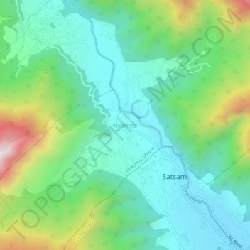
Name: Nyamed topographic map, elevation, terrain.
Location: Nyamed, Nyechhu_Shar-ri, Tsento Gewog, Paro District, Bhutan (27.44971 89.32655 27.48971 89.36655)
Average elevation: 2,581 m
Minimum elevation: 2,327 m
Maximum elevation: 3,231 m
Thank you for supporting this site ❤️
Make a donation
Make a donation
Gear up for your next adventure:
As an Amazon Associate, this site earns from qualifying purchases at no extra cost to you.