

Karbach topographic map
Click on the map to display elevation.
Karbach
The municipality lies in the Hunsrück some 4 km east of Emmelshausen and 7 km west of Sankt Goar, the town on the Rhine. It is linked to the national road network by the Autobahn A 61 (Emmelshausen interchange) and Bundesstraße 327, also called the Hunsrückhöhenstraße (“Hunsrück Heights Road”, a scenic road across the Hunsrück built originally as a military road on Hermann Göring’s orders). Karbach's area is 498 ha and its elevation is 500 m above sea level.
About this map

Name: Karbach topographic map, elevation, terrain.
Average elevation: 416 m
Minimum elevation: 151 m
Maximum elevation: 531 m
Other topographic maps
Click on a map to view its topography, its elevation and its terrain.
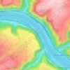
Rhine Gorge
Germany > Rhineland-Palatinate > Rhein-Hunsrück-Kreis > Sankt Goar > Biebernheim
Average elevation: 177 m
Rhine Gorge
Germany > Rhineland-Palatinate > Rhein-Hunsrück-Kreis > Sankt Goar > Biebernheim
Average elevation: 177 m