
Lohfelden topographic map
Interactive map
Click on the map to display elevation.
About this map
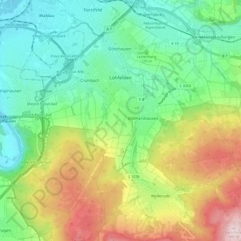
Name: Lohfelden topographic map, elevation, terrain.
Location: Lohfelden, Landkreis Kassel, Hesse, 34253, Germany (51.22898 9.51312 51.29026 9.62685)
Average elevation: 261 m
Minimum elevation: 133 m
Maximum elevation: 495 m
Other topographic maps
Click on a map to view its topography, its elevation and its terrain.