
Les Mesniers topographic map
Interactive map
Click on the map to display elevation.
About this map
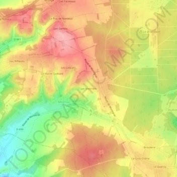
Name: Les Mesniers topographic map, elevation, terrain.
Average elevation: 126 m
Minimum elevation: 49 m
Maximum elevation: 179 m
Other topographic maps
Click on a map to view its topography, its elevation and its terrain.
Le Maine Quérant
France > Nouvelle-Aquitaine > Charente > Mornac
Le Maine Quérant, Mornac, Angoulême, Charente, Nouvelle-Aquitaine, France métropolitaine, 16600, France
Average elevation: 120 m