Geolocate

Tellego topographic map

Click on the map to display elevation.

About this map

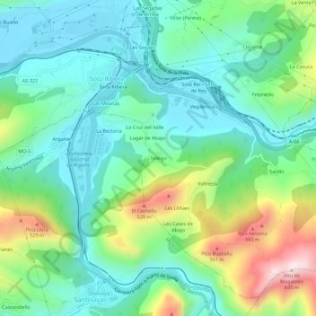
Name: Tellego topographic map, elevation, terrain.

Location: Tellego, Soto Ribera, Ribera de Arriba, Asturias, 33173, Spain (43.27873 -5.88748 43.31873 -5.84748)

Average elevation: 257 m

Minimum elevation: 112 m

Maximum elevation: 625 m

Gear up for your next adventure:

🥫Expedition Meals - Lightweight, high-calorie nutrition for long-distance hikers
Camping Shelters - Emergency and lightweight shelters for outdoor use
🎒Hiking Backpacks - Comfortable backpacks for day hikes and multi-day treks
🧤Waterproof Overmitts - Extreme weather protection for hikers and mountaineers
🧺Mesh Stuff Sacks - Breathable storage for wet gear or camp organization

As an Amazon Associate, this site earns from qualifying purchases at no extra cost to you.