
Nuth topographic map
Click on the map to display elevation.
About this map
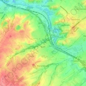
Name: Nuth topographic map, elevation, terrain.
Location: Nuth, Beekdaelen, Limburg, Netherlands (50.90400 5.83571 50.93499 5.92021)
Average elevation: 95 m
Minimum elevation: 57 m
Maximum elevation: 139 m
Other topographic maps
Click on a map to view its topography, its elevation and its terrain.