
Snæfellsjökull topographic map
Interactive map
Click on the map to display elevation.
About this map
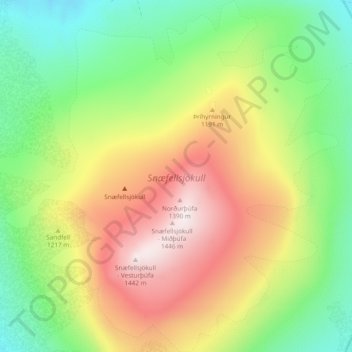
Name: Snæfellsjökull topographic map, elevation, terrain.
Location: Snæfellsjökull, Snæfellsbær, Western Region, Iceland (64.78821 -23.82419 64.82862 -23.73414)
Average elevation: 962 m
Minimum elevation: 632 m
Maximum elevation: 1,412 m