
دهستان سلیمان topographic map
Interactive map
Click on the map to display elevation.
About this map
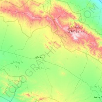
Name: دهستان سلیمان topographic map, elevation, terrain.
Location: دهستان سلیمان, بخش سلیمان, Zaveh County, Razavi Khorasan, Iran (35.12835 59.58302 35.46657 60.13058)
Average elevation: 1,734 m
Minimum elevation: 1,191 m
Maximum elevation: 2,942 m
Other topographic maps
Click on a map to view its topography, its elevation and its terrain.