
Garmsir topographic map
Interactive map
Click on the map to display elevation.
About this map
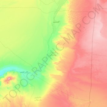
Name: Garmsir topographic map, elevation, terrain.
Location: Garmsir, Helmand Province, Afghanistan (30.22033 63.31681 31.28565 64.72768)
Average elevation: 861 m
Minimum elevation: 608 m
Maximum elevation: 1,261 m
Other topographic maps
Click on a map to view its topography, its elevation and its terrain.