
Lazo Marsh-North East Comox Wildlife Management Area topographic map
Interactive map
Click on the map to display elevation.
About this map
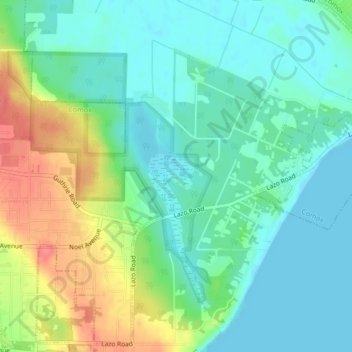
Name: Lazo Marsh-North East Comox Wildlife Management Area topographic map, elevation, terrain.
Average elevation: 21 m
Minimum elevation: 0 m
Maximum elevation: 65 m
Other topographic maps
Click on a map to view its topography, its elevation and its terrain.
Waveland
Canada > British Columbia > Comox Valley Regional District > Area B (Lazo North)
Average elevation: 38 m