Geolocate

Larap topographic map

Click on the map to display elevation.

About this map

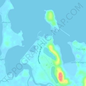
Name: Larap topographic map, elevation, terrain.

Location: Larap, Camarines Norte, Bicol Region, 4606, Philippines (14.27908 122.62879 14.31908 122.66879)

Average elevation: 5 m

Minimum elevation: -4 m

Maximum elevation: 89 m

Other topographic maps

Click on a map to view its topography, its elevation and its terrain.

Bagasbas Beach

Philippines > Camarines Norte > Daet > Bagasbas

Average elevation: 1 m

Daet

Philippines > Camarines Norte

Average elevation: 6 m

Vinzons

Philippines > Camarines Norte

Average elevation: 10 m

Tailon Island

Philippines > Camarines Norte

Average elevation: 0 m

Gear up for your next adventure:

👕Technical Hiking Tees - Moisture-management for high-exertion climbs
👖Packable Overtrousers - Quick-deploy rain protection for legs in sudden storms
🧘Folding Sit Mats - Dry and warm seat for map-reading breaks on damp ground
📷Camera Straps - Secure straps for carrying cameras while walking
🥤Hiking Water Bottles - Reusable bottles for hydration on the trail

As an Amazon Associate, this site earns from qualifying purchases at no extra cost to you.